Understand the risk, the types of disaster
1. Understand the Risks and Types of Disaster
Natural disasters can occur with little or no warning and often have serious consequences for individuals, communities, the economy, and the environment. Across Tasmania, and particularly in regions like Northern Tasmania and the Meander Valley municipality, bushfires, floods, and severe storms are recurring threats.
While some disasters—such as earthquakes or extreme weather events—may be less frequent, it is still essential to be informed and prepared for all potential hazards.
This section provides detailed information on various types of disasters that may affect the Meander Valley municipality. For each disaster type, you’ll find resources to help you:
- Understand the nature and risks of the disaster
- Evaluate your level of exposure and vulnerability
- Take proactive steps to prepare and protect yourself, your family, and your property
Awareness is the foundation of safety. By understanding the risks, you can take meaningful action to reduce harm. Stay informed. Stay prepared. Stay safe.
Get Ready for Emergencies is a guide prepared by the State Emergency Service (SES) for individuals and households to prepare for emergencies.
Flood
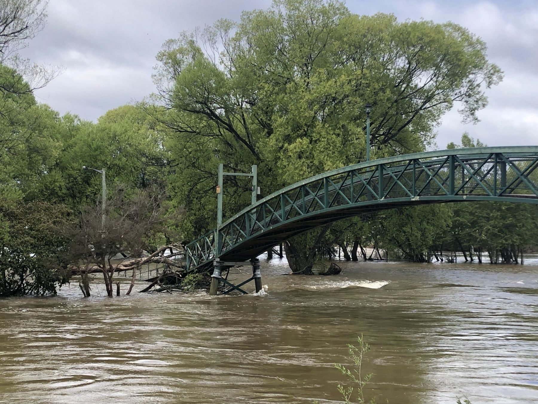
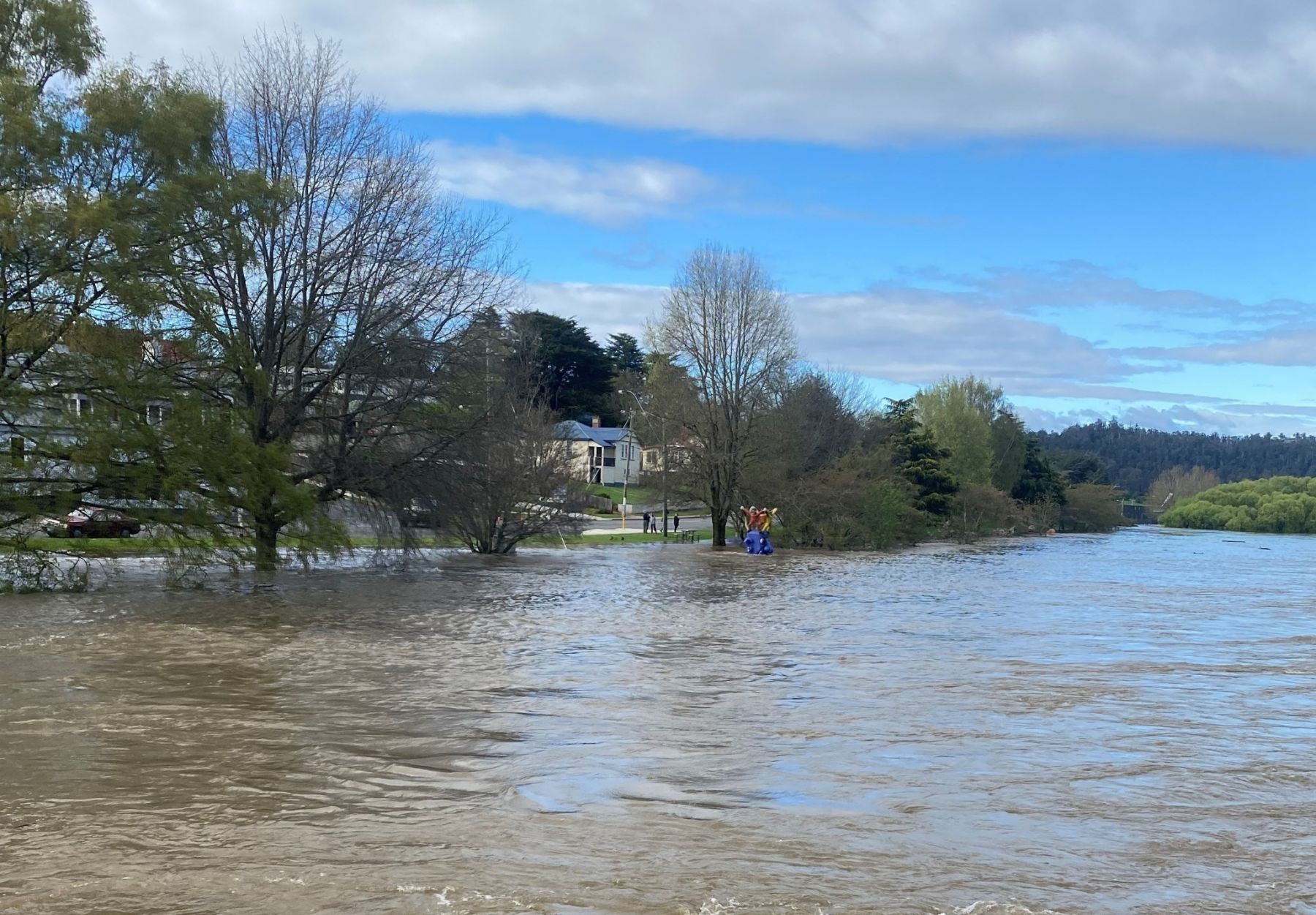
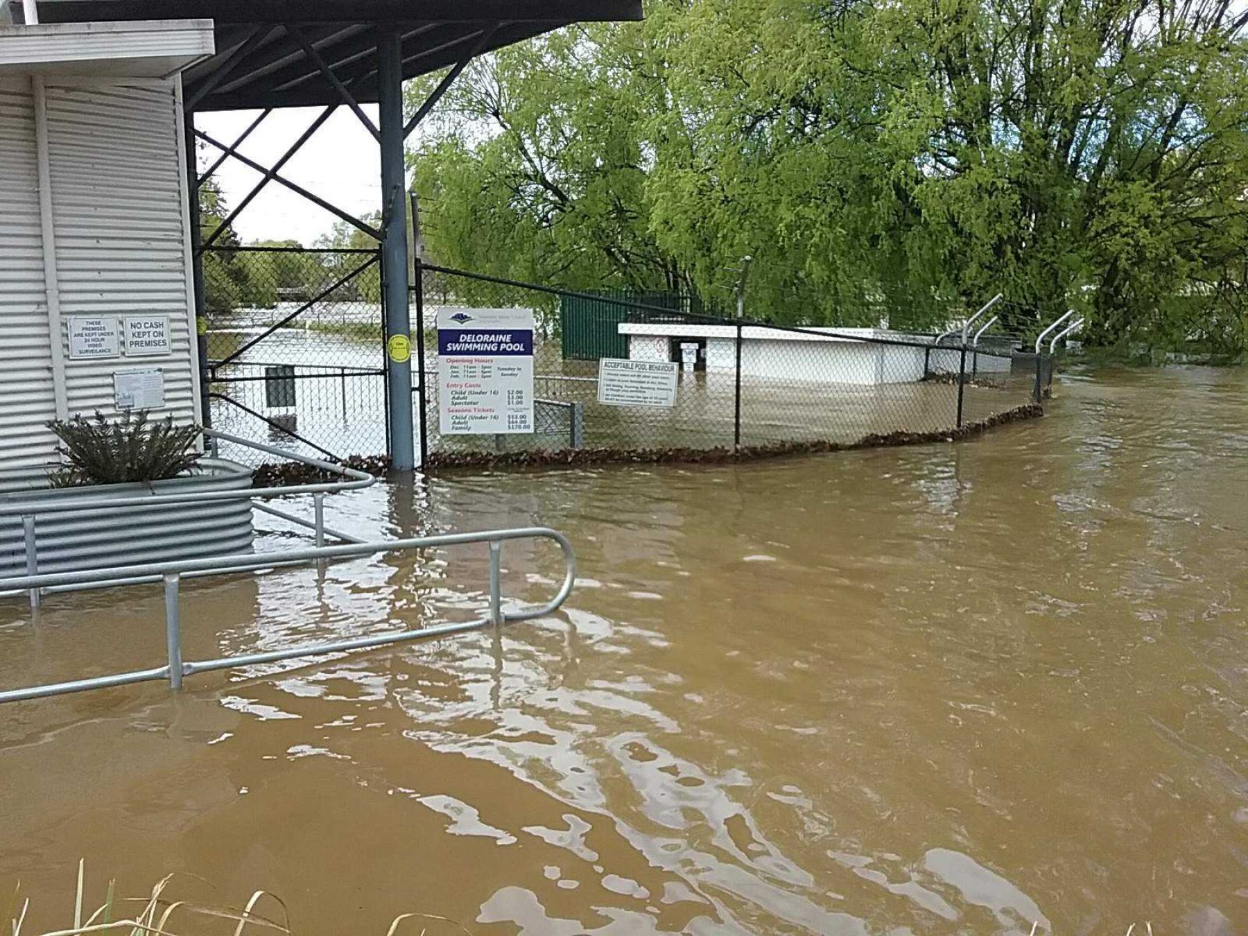
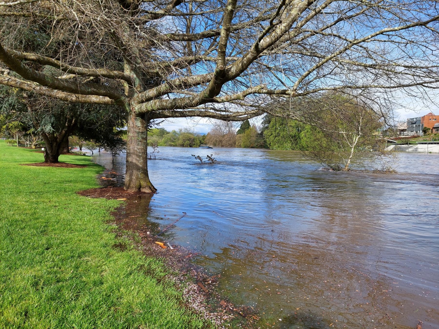
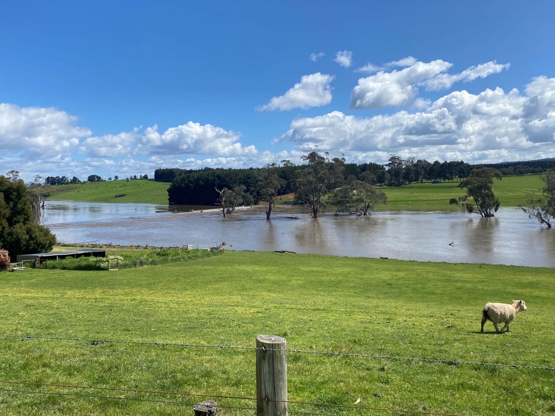
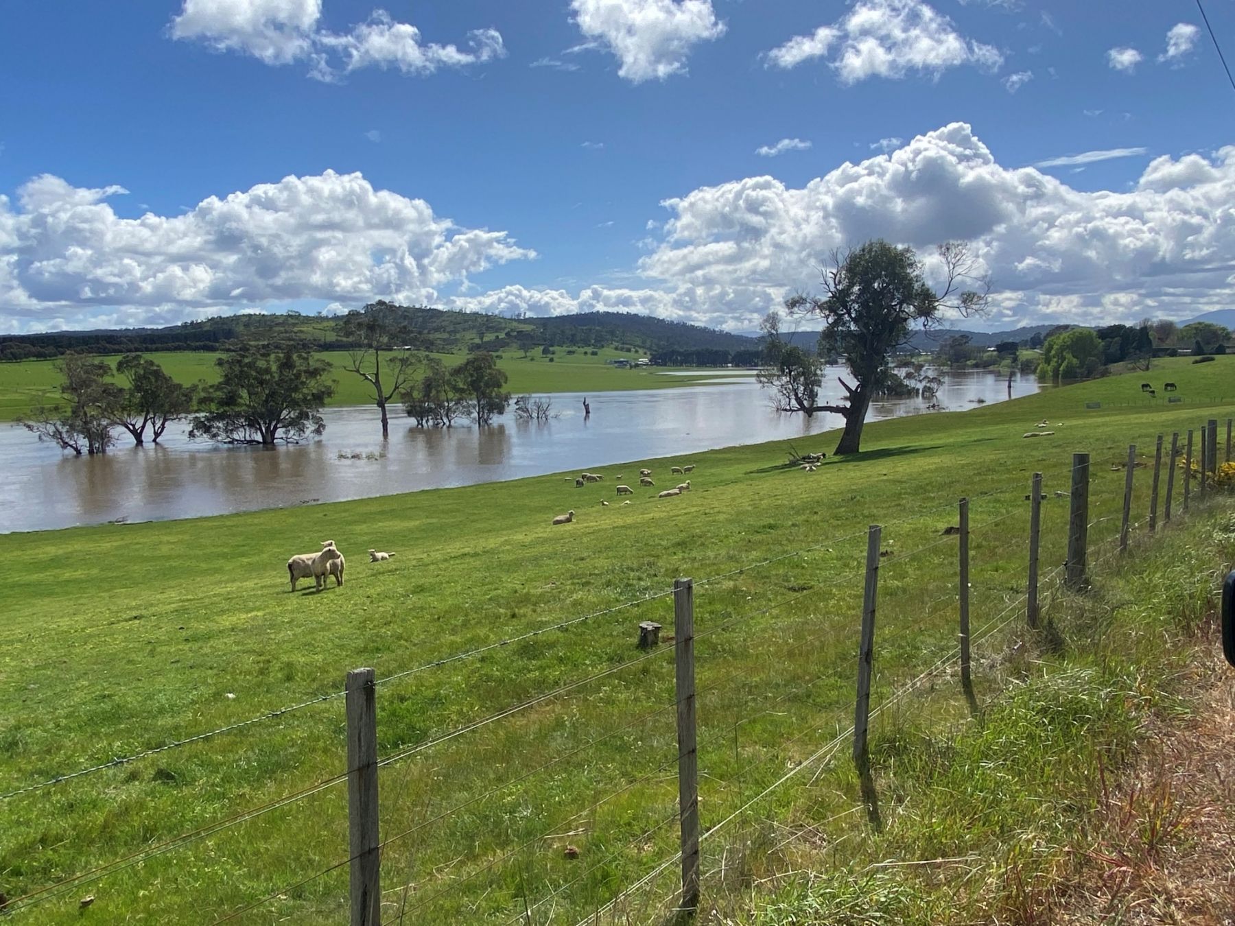
A flood is a natural disaster that occurs when water overflows onto normally dry land. It can result from heavy rainfall, rapid snowmelt, storm surges, or the failure of dams and levees. Flooding can happen without warning and can cause significant damage to homes, roads, infrastructure, and natural ecosystems, and may pose serious risks to health and safety. It's important to be prepared.
The State Emergency Service (SES) have prepared detailed flood guides tailored to the Meander Valley area, which offers practical advice on how to protect your home, stay safe, and plan ahead.
Access the flood guides here to make sure you have all the information needed to be flood-ready.
Flash Flooding
Flash flooding happens when intense rainfall falls in a short amount of time. It can occur suddenly, often with little warning, and is extremely dangerous due to the speed and force of the water.
In parts of the Meander Valley Municipality, flash flooding can affect low-lying areas, rural roads, and creek crossings—especially where drainage is limited or natural waterways are already full. The region's varied terrain, combined with intense rainfall, can lead to rapid water runoff and localised flooding in both rural and township areas.
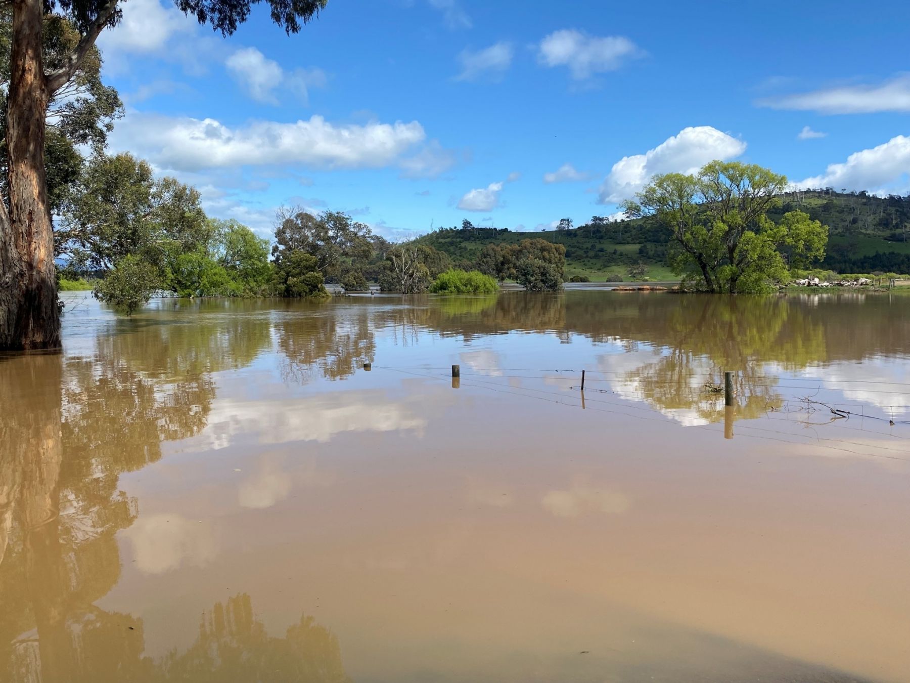
Riverine Flooding
Riverine flooding occurs when prolonged or heavy rainfall causes rivers, creeks, or streams to exceed their capacity and overflow. This can happen over several days or weeks as water levels gradually rise and spill over the banks, leading to widespread flooding in nearby areas.
Floods are classified into three main categories—minor, moderate, and major—based on the extent of inundation and potential impact on communities and infrastructure.
Minor flooding
Minor flooding typically causes local inconvenience. Low-lying areas near rivers, creeks, or drains may become inundated.
- Minor roads and low-level bridges may be closed.
- In urban areas, water may affect backyards, underground spaces, or buildings below floor level.
- Shared paths for pedestrians and cyclists can become submerged.
- In rural areas, precautionary relocation of livestock and equipment may be necessary.
Moderate flooding
Moderate flooding affects a wider area and begins to impact essential services and infrastructure.
- Main traffic routes may be cut off.
- Some buildings may be flooded above floor level.
- Evacuations may be required.
- In rural regions, moving livestock becomes essential for safety.
Major flooding
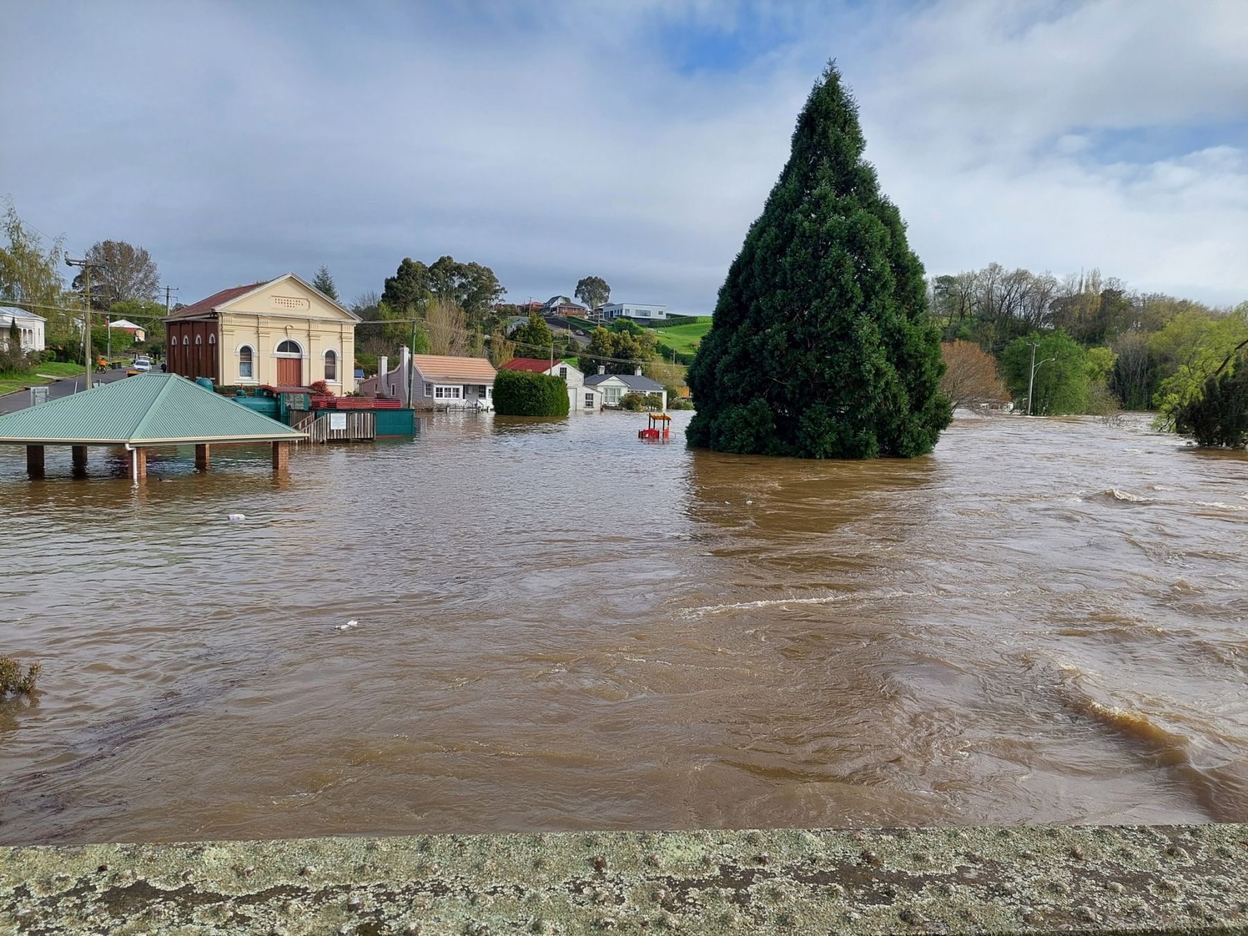
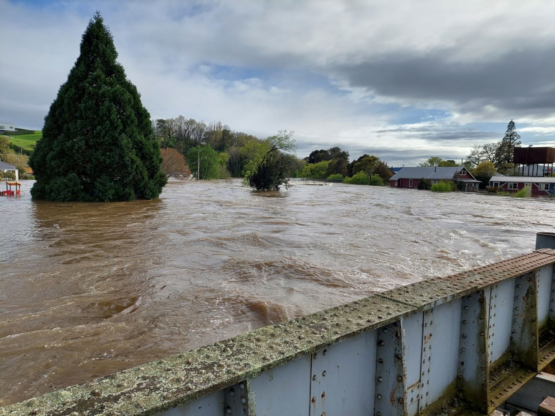
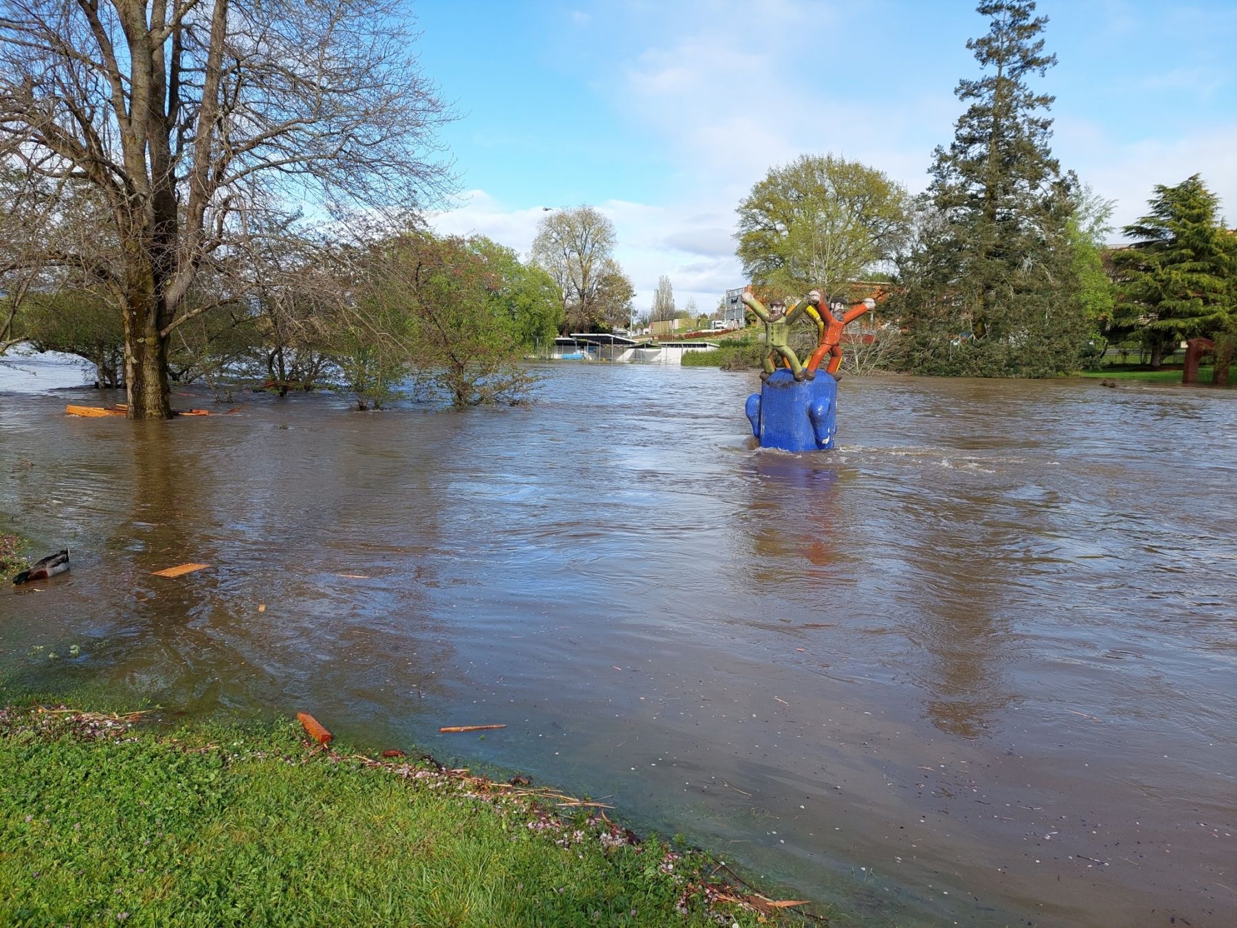
If the water level reaches the major flood level large areas are inundated. Many buildings may be affected above floor level. Properties and towns may be isolated and major traffic routes closed. Evacuation may be required. Utility services may be affected.
Major flooding results in extensive and often prolonged inundation.
- Large areas may be underwater, including towns and significant infrastructure.
- Many buildings may be affected above floor level.
- Major roads and highways may be closed, and communities could become isolated.
- Evacuation is likely, and critical services such as power, water, and communications may be disrupted.
To learn more about flood risks and how to stay prepared, visit the Bureau of Meteorology’s Flood Knowledge Centre.
Flooding can affect different areas in different ways. Your location plays a key role in determining how likely you are to experience flooding and what type of flooding may occur.
By understanding the type of flood risk in your area, you’ll be better prepared for:
- How quickly flooding may occur
- How long floodwaters may remain elevated
- Where water is likely to flow or accumulate
- How it might affect your home, workplace, or transport routes
Importantly, even if your home isn’t directly at risk of flooding, you can still be significantly impacted. Flood-related isolation is a real concern for people living in elevated or seemingly safe areas. If surrounding roads are flooded, you may be unable to leave your home or reach your workplace until waters recede.
Knowing your flood risk helps you make informed decisions before, during, and after a flood emergency.
The Meander Valley Flood Maps provides information on the likelihood risk of your property flooding. The base flood layer is automatically set to show the extent of a 1% AEP* flood however this can be changed by choosing different layers.
Annual Exceedance Probability (AEP) is a term used to the express the percentage of likelihood of a flood of a given size or larger occurring in a given year. If a flood has an AEP of 1%, it has a one in 100 likelihood of occurring in any given year.
Check the Meander Valley Flood Maps to assess your level of riverine flood risk.
Check the Urban (Stormwater) Flooding Map for flash flooding storm water flood maps.
*AEP - Annual Exceedance Probability
Everyone should take particular care around stormwater infrastructure—such as drains, manholes, pits, and grates—as they can pose serious dangers in both dry and wet weather.
Across Meander Valley, the stormwater system plays a crucial role in protecting homes, streets, and public areas by carrying rainwater away during storms and heavy rainfall. While the network isn’t visible from the surface, it stretches across the municipality and includes everything from short roadside pipes to larger underground channels.
These systems can vary greatly in size—some pipes span just a few metres, while others run for long distances. They often include debris traps and deep pits with no ladders or exit points.
In dry weather, these spaces may become habitats for animals such as rats, snakes, and spiders. But when it rains heavily, the stormwater system can fill rapidly and with great force, creating dangerous conditions. Items like bicycles, bins, and even large debris can be swept in—posing a risk to people nearby.
Fast-Moving Stormwater is Extremely Dangerous
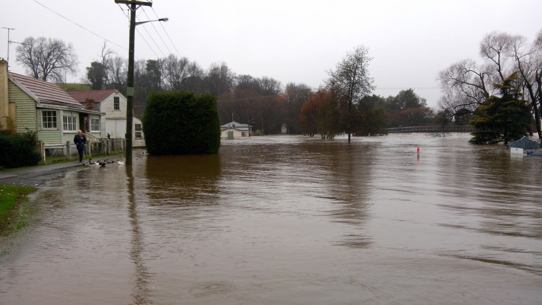
Floodwaters and fast-flowing stormwater can easily knock someone off their feet, sweeping them into drains or downstream. Debris hidden under the water adds to the danger. These conditions can also lift and carry away vehicles attempting to cross flooded roads or causeways.
Never drive or walk through floodwaters.
Even shallow water can be powerful enough to cause harm. Turn around and find a safer route.
Roads are often affected by floodwaters before properties, and being caught off guard can leave you and your family isolated. Staying informed about local road conditions is essential—especially during and after heavy rainfall.
Many drivers rescued from floodwaters later say they were simply trying to get home quickly. But no matter the urgency, or the type of vehicle, driving through floodwater is extremely dangerous.
Please remember:
-
Most flood-related deaths occur at night and involve vehicles driving into flooded roads.
-
Creeks, rivers, and drainage systems can rise rapidly, often faster than expected.
-
The road surface underneath floodwater may be washed away or severely damaged, making the water much deeper and more dangerous than it appears.
-
Once a vehicle is swept away, it can roll onto its side or flip, giving occupants very little time to escape.
Never drive through floodwaters. Turn around and find a safer route—it could save your life.
Bushfire
A bushfire—also known as a wildfire—is an uncontrolled fire that burns rapidly through vegetation such as forests, grasslands, and bushland. Driven by dry conditions, high temperatures, and strong winds, bushfires pose serious threats to lives, property, and the environment.
Bushfires occur when both managed and unmanaged vegetation ignites and spreads through areas like national parks, reserves, private properties, and urban fringes. They are more likely to occur during hot, dry, and windy weather. The risk increases with:
-
High temperatures
-
Low relative humidity
-
Strong winds
Bushfires can be sparked by human activity (accidental or deliberate) or natural causes like lightning.
Impacts of Bushfire
Bushfires are dangerous not only because of the flames but also due to the heat, smoke, and embers they produce. Key hazards include:
-
Radiant heat: Can be felt over 100 metres from a large fire and can melt or fracture materials like car parts and glass.
-
Spot fires: Embers can travel several kilometres ahead of the main fire, starting new fires in unexpected places.
-
Smoke and air quality: Bushfire smoke contains fine particles and toxic gases that can impair visibility, trigger breathing difficulties, and worsen heart and respiratory conditions. It can also impact diabetes control and increase the risk of heart attack or stroke.
To find out more about bush fire weather visit Fire Weather Knowledge Centre.
People living near bushland or in rural residential areas are at greater risk than those in more built-up urban environments. To assess your individual risk and prepare accordingly:
-
Visit Risk Ready – TasALERT to check the bushfire risk at your home or business location.
-
Explore Community Protection Plans and create your Bushfire Survival Plan through the Tasmania Fire Service.
Protecting Your Health
For health advice during smoke events, including how to reduce your exposure and protect vulnerable family members:
New Tool: Bushfire Resilience Rating App
Australians now have free access to the Bushfire Resilience Rating App, developed by the Resilient Building Council (RBC) with support from the Australian Government. The app helps property owners:
-
Assess their bushfire risk
-
Take site-specific actions to reduce vulnerability
-
Potentially lower insurance premiums
Learn more and get started: Bushfire Resilience Assessment – RBC
Fire Management Objectives
The following objectives guide the management of bushfire risk across Council-managed reserves, balancing community safety, environmental conservation, and operational effectiveness:
1. Manage Fuel Loads Across Reserves
To reduce bushfire intensity and impact by:
-
Minimising the severity of unplanned fires
-
Reducing the chance of fire entering reserves and causing catastrophic damage
-
Increasing the ability to control fires within reserves
-
Protecting physical, cultural, and ecological assets
-
Reducing fire risk to neighbouring properties
-
Supporting safe and enjoyable visitor experiences in Council reserves
2. Support Biodiversity
Maintain or enhance biodiversity by using mosaic burning techniques that vary the timing, intensity, and location of burns to mimic natural fire patterns and support diverse ecosystems.
3. Control Weeds
Use targeted burning, combined with pre-burn and post-burn weed treatments, to reduce invasive species and promote native vegetation recovery.
4. Maintain Fire Infrastructure
Ensure that fire access tracks, water points, and control lines are maintained and developed to:
-
Enable effective fuel reduction activities
-
Support safe and efficient wildfire suppression
5. Improve Operational Efficiency
Coordinate cross-tenure fuel and vegetation management by:
-
Identifying shared infrastructure and access opportunities
-
Aligning practices with neighbouring landholders and agencies
6. Enhance Data and Planning
Maintain a central, accessible fire management database for each reserve to:
-
Support better planning and operational decision-making
-
Improve readiness and coordination during fire incidents
7. Engage Stakeholders and the Community
Involve the community, Traditional Owners, local stakeholders, and relevant agencies in the fire management planning process to build shared responsibility and inclusive decision-making.
8. Promote Fire Awareness and Risk Reduction
Improve public understanding of:
-
Bushfire hazards
-
Practical steps residents can take to reduce risks around their homes and within local reserves
-
How fire is managed in their region
Storm
Storms—particularly thunderstorms—can develop quickly and with little warning, bringing dangerous conditions such as strong winds, heavy rain, hail, and lightning. Understanding your storm risk and having a plan in place can help you protect your family, home, business, and animals from harm.
Storms are weather events that may include:
-
Heavy rainfall and flash flooding
-
Damaging winds
-
Lightning strikes
-
Large hail
Storms can last for hours and travel long distances, causing widespread damage. They can:
-
Damage homes, vehicles, and crops
-
Disrupt power and communications
-
Create hazardous driving conditions
-
Cause injuries or fatalities due to falling trees, flying debris, and flash flooding
What Is a Severe Storm?
According to the Bureau of Meteorology, a severe storm is one likely to produce one or more of the following:
-
Hail larger than 2 cm in diameter
-
Wind gusts exceeding 90 km/h
-
Rainfall intense enough to cause flash flooding
A severe storm warning is issued when these dangerous conditions are expected.
For more information, visit the Bureau of Meteorology – Severe Weather Knowledge Centre.
Storms can happen anywhere and at any time of year. While most severe storms occur between September and March, winter storms driven by cold fronts are also common in:
-
South-east South Australia
-
South-west Western Australia
-
Tasmania
No matter your location, it's important to stay informed and be ready.
Storm Safety Tips
During a storm, take the following precautions to reduce harm:
-
Supervise children and keep them indoors
-
Ensure family and neighbours are aware of weather warnings
-
Secure pets and livestock
-
Bring in or tie down loose outdoor items (furniture, trampolines, bins, toys)
-
Charge devices and prepare for possible power outages
-
Park vehicles under cover, away from trees and power lines
-
Stay indoors and avoid sheltering under trees
-
Avoid using landline telephones during lightning storms
-
Be cautious on the roads—delay travel if possible and never drive through floodwaters
Being prepared before a storm hits can make a big difference. Use this checklist to build a Storm Emergency Kit that will help keep you and your family safe, comfortable, and connected during power outages, flooding, or isolation.
🌩️ Storm Emergency Kit Checklist
Prepare a portable emergency kit to help you and your household stay safe and self-sufficient during and after a storm. Your kit should include:
Essentials
-
Battery-powered or wind-up radio (for weather updates)
-
Fully charged power bank(s) for mobile devices
-
Torch or headlamp (plus spare batteries)
-
First aid kit
-
Important documents (ID, insurance, medication list, property title) in waterproof packaging
-
Cash (ATMs and EFTPOS may be down during power outages)
-
Copies of emergency contact numbers
Food & Water
-
Bottled water (at least 3 litres per person, per day)
-
Non-perishable food items (e.g., canned goods, muesli bars)
-
Manual can opener
-
Baby formula and food (if required)
-
Pet food and supplies
Other Items
-
Blankets or sleeping bags
-
Spare clothes and sturdy shoes
-
Medications and prescriptions
-
Face masks (for dust, debris, or post-storm cleanup)
-
Sanitary and hygiene items (e.g., hand sanitiser, toilet paper)
Tip: Store your kit in a waterproof container and keep it in an easy-to-reach place. Check it every 6 months to replace expired items.
🔧 After the Storm: Safety & Recovery Checklist
Once the storm has passed, be cautious when inspecting your property or returning to outdoor areas. Follow these steps to stay safe:
Safety First
-
Listen to local authorities and weather services for updates
-
Do not touch fallen power lines or attempt electrical repairs—report hazards to TasNetworks or emergency services
-
Check on vulnerable neighbours, family members, and friends
-
Avoid flooded areas and debris; hidden dangers may include sharp objects, unstable ground, or contaminated water
Home & Property Inspection
-
Use a torch, not matches or lighters, when entering damaged buildings (gas leaks are possible)
-
Inspect for structural damage before re-entering your home
-
Photograph damage for insurance claims
-
Dispose of spoiled food and check water quality advisories
Clean-Up Tips
-
Wear gloves, boots, and protective clothing
-
Be cautious of wildlife (e.g., snakes, spiders) displaced by the storm
-
Only use generators outdoors and away from windows to avoid carbon monoxide poisoning
Insurance & Support
-
Contact your insurer as soon as possible
-
Keep receipts for emergency repairs or accommodation
-
Access local council, emergency relief, or government assistance if needed
Landslide
A landslide is the rapid movement of rock, soil, and debris down a slope or hillside. Often triggered by heavy rainfall, earthquakes, or human activity, landslides can be sudden, powerful, and highly destructive—posing serious risks to life, property, and infrastructure.
Landslides involve the downward movement of large amounts of earth, rock, sand, or mud—or a combination of these materials. They can:
-
Move at varying speeds—from a few centimetres to several kilometres per hour
-
Travel short distances or span across entire landscapes
-
Be triggered by natural events (e.g. earthquakes, storms) or human disturbances (e.g. construction, deforestation)
In Meander Valley, heavy rain is the most common trigger, especially when the soil on a hillside becomes saturated beyond the point where vegetation can hold it in place. The top layer of wet soil may then slip, taking everything in its path downhill.
Landslides can happen with little warning. It’s important to be aware of the risk on your property—especially if you live on or near a slope.
Before purchasing land or starting construction, visit the TasALERT website to check for:
Past landslide activity
MRT Landslide Database – Web Map Viewer
Landslide Points Data – Download (Data.gov.au)
Known risk assessments
Landslide Damage Points Data – Download
Geohazards Data – MRT Downloads Portal
Local hazard maps
Tasmanian Landslide Map Series – MRT Map Downloads
Landslide Planning Map Update (2024) – Technical Report PDF
Child Safety and Small-Scale Landslides
Sadly, some of the most common victims of smaller landslides are children, often during outdoor play. Tragic incidents have occurred when:
-
Children dig beneath large rocks to build cubby houses, causing the rock to collapse
-
They dig into sandbanks that then collapse and bury them
-
They sit or play on unstable rock ledges that break away
Parents and guardians should explain the dangers of unstable terrain and always supervise children during outdoor play—especially in hilly, sandy, or rocky environments.
Heatwave
A heatwave is an extended period of unusually high temperatures, often accompanied by high humidity. These conditions can be dangerous, especially when temperatures remain elevated for several days and nights without relief. Heatwaves pose serious health risks and can lead to heat-related illnesses and emergencies.
Although heatwaves are not traditionally considered a major risk in Tasmania, rising temperatures, ageing infrastructure designed for colder climates, and increasing weather unpredictability mean that heatwaves are becoming more significant and should not be overlooked.
A heatwave is defined as a prolonged period of excessively hot weather, which may or may not be accompanied by high humidity, depending on local climate patterns.
Heatwaves can affect everyone, but certain groups are more vulnerable to heat stress and health complications. These include:
-
Babies, infants, and young children
-
Older adults, especially those over 65 or who are frail
-
Pregnant women
-
People with chronic medical conditions such as:
-
Asthma
-
Heart disease
-
Respiratory illness
-
Diabetes
-
Dementia or Alzheimer’s
-
Serious mental health conditions
-
-
People with physical disabilities or limited mobility
-
Those taking medications that affect body temperature or sweating
-
Anyone with a fever from an existing infection
-
Outdoor workers and people engaging in physical activity
-
Pets and animals
Even short exposure to extreme heat can lead to heat exhaustion, heatstroke, or exacerbation of existing medical conditions.
Learn More and Stay Informed
For up-to-date heatwave alerts and guidance, visit:
-
BoM Knowledge Centre – Bureau of Meteorology
-
Heatwave Knowledge Centre – Australian Institute for Disaster Resilience (AIDR)
Earthquake
Earthquakes can happen with little or no warning and may cause widespread damage depending on their strength and location. They occur when stress builds up underground and is suddenly released, shaking the ground and potentially impacting buildings, infrastructure, and communities.
Earthquakes are the vibrations caused by rocks breaking under stress. The underground surface where the rock breaks and moves is known as a fault plane. Depending on the magnitude of the earthquake, strong and potentially destructive ground shaking can be felt tens or even hundreds of kilometres from the earthquake’s epicentre.
The magnitude of an earthquake is a measure of the energy it releases. This is determined using a seismograph, which records the amplitude of the seismic waves and the distance from the earthquake. These measurements are used to calculate the earthquake’s magnitude.
For more detailed information on earthquakes in Australia, visit Geoscience Australia – Earthquake.
While Tasmania is not known for frequent or severe earthquakes, they can still occur. Most earthquakes are small and cause little to no damage—events below magnitude 3.5 are typically not felt or are only minor.
However, larger earthquakes have been recorded. In 1929, an offshore earthquake caused damage to buildings in Launceston. Although rare, stronger events can impact older, unreinforced masonry buildings.
Being aware of the potential, however low, can help you stay informed and better prepared—especially if you live or work in an older structure.
For more information, visit Geoscience Australia Earthquake@GA and TasALERT.
Housefire
A fire in the home can be devastating—causing serious injury, loss of life, and major property damage. Fires spread quickly, and even a small flame can become life-threatening within minutes. While the risk is real, there is a lot you can do to prevent housefires and protect the people and things you care about most.
Each year, the Tasmania Fire Service (TFS) responds to more than 350 house fires. Sadly, Tasmania has one of the highest fire fatality rates per capita in Australia. But many of these tragedies are preventable.
Making your home fire-safe and knowing what to do in an emergency can mean the difference between life and death.
Protect Your Home and Family
The TFS Home Fire Safety website provides essential advice on how to:
- Identify and reduce fire risks in the home
- Create and practise a home fire escape plan
- Use smoke alarms effectively
- Stay safe when cooking, using heaters, or lighting candles
Everyone—whether a homeowner, renter, or landlord—has a role to play in fire prevention.
Keep reading?
Other Hazards
While some emergencies can be predicted and prepared for, others are less common and harder to anticipate. It's important to be aware of these risks so you can act quickly and stay informed.
Other Hazards to Be Aware Of:
- Terrorism: Although unlikely, terrorism remains a potential threat. Stay informed via TasALERT – Terrorism.
- Pandemic: As seen during COVID-19, pandemics can cause widespread disruption. Learn more at TasALERT – Pandemic.
- Tsunami: Though rare, tsunamis can impact coastal areas. Stay updated through TasALERT – Tsunami.
- Manmade Disasters: These include industrial accidents, hazardous material spills, nuclear incidents, and deliberate acts such as cyberattacks or sabotage. Awareness and emergency planning are key to reducing their impact.
Meander Valley Emergency Events


With thanks to the City of Launceston's Emergency Management Team for making the information they compiled and contextualised available for adaptation to the Meander Valley community.